From Government Hill to Fort Canning Hill
Government Hill
Following the arrival of the British in 1819, they swiftly claimed Bukit Larangan as their own. Aside from hoisting the Union Jack atop its summit, a bungalow was constructed on the hill. In 1823, they changed the hill’s name to “Government Hill,” although it was sometimes referred to as “Singapore Hill,” “Bukit Bendera” (which means “Flag Hill”), or simply “The Hill”.
The Union Jack on Fort Canning Hill was raised by the first British Resident and Commandant of Singapore (1819–1823), William Farquhar. It was later used for several purposes, including informing the settlement about the arrival of ships in the harbour. The hoisting of the flag captivated the locals, as the hill was believed to be haunted and deserted at the time. Munshi Abdullah recounted the incident in his autobiography, Hikayat Abdullah (2009) (p. 146). Click or tap HERE to read the account. (Source: Call no.: RSING 959.5 ABD)
“One day Colonel Farquhar wanted to ascend the Forbidden Hill...The Temenggong’s men said, ‘None of us have the courage to go up the hill because there are many ghosts on it. Every day one can hear on it sounds as of hundreds of men. Sometimes one hears the sound of heavy drums and of people shouting.’ Colonel Farquhar laughed and said, ‘I should like to see your ghosts’ and turning to his Malacca men ‘Draw this gun to the top of the hill.’ Among them there were several who were frightened, but having no option they pulled the gun up. All who went up were Malacca men, none of the Singapore men daring to approach the hill. On the hill there was not much forest and not many large trees, only a few shrubs here and there. Although the men were frightened, they were ashamed by the presence of Colonel Farquhar and went up whether they wanted or not. When they reached the top Colonel Farquhar ordered the gun to be loaded and then he himself fired twelve rounds in succession over the top of the hill in front of them. Then he ordered a pole to be erected on which he hoisted the English flag. He said, ‘Cut down all these bushes.’ He also ordered them to make a path for people to go up and down the hill. Everyday there was this work being done, the undergrowth being slashed down and a pathway cleared.”
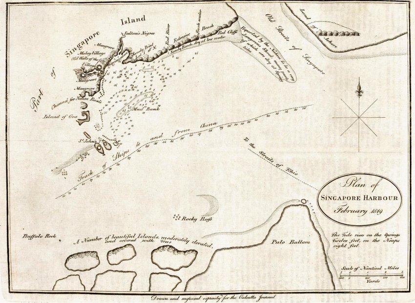 |
| Fort Canning Hill is depicted in many early maps of Singapore, including this survey map by Captain Daniel Ross. Titled “Plan of the Singapore Harbour”, it was commissioned by Raffles days after his first arrival at Singapore and published in the May 1819 issue of The Calcutta Journal. In the map, Fort Canning Hill is shown situated at the north bank of a river inlet (Singapore River) near its mouth. The hill, which is unnamed in the map, overlooks a cluster of villages. Its walls are indicated with the description, “Old Walls of the City”. Captain Ross’s map is one of the earliest known surveys of Singapore Harbour that marked the first appearance of the name “Singapore” rather than “Singapoora” or “Sincapore” on a map or chart. (Image Credit: Survey Department, Courtesy of National Archives of Singapore) |
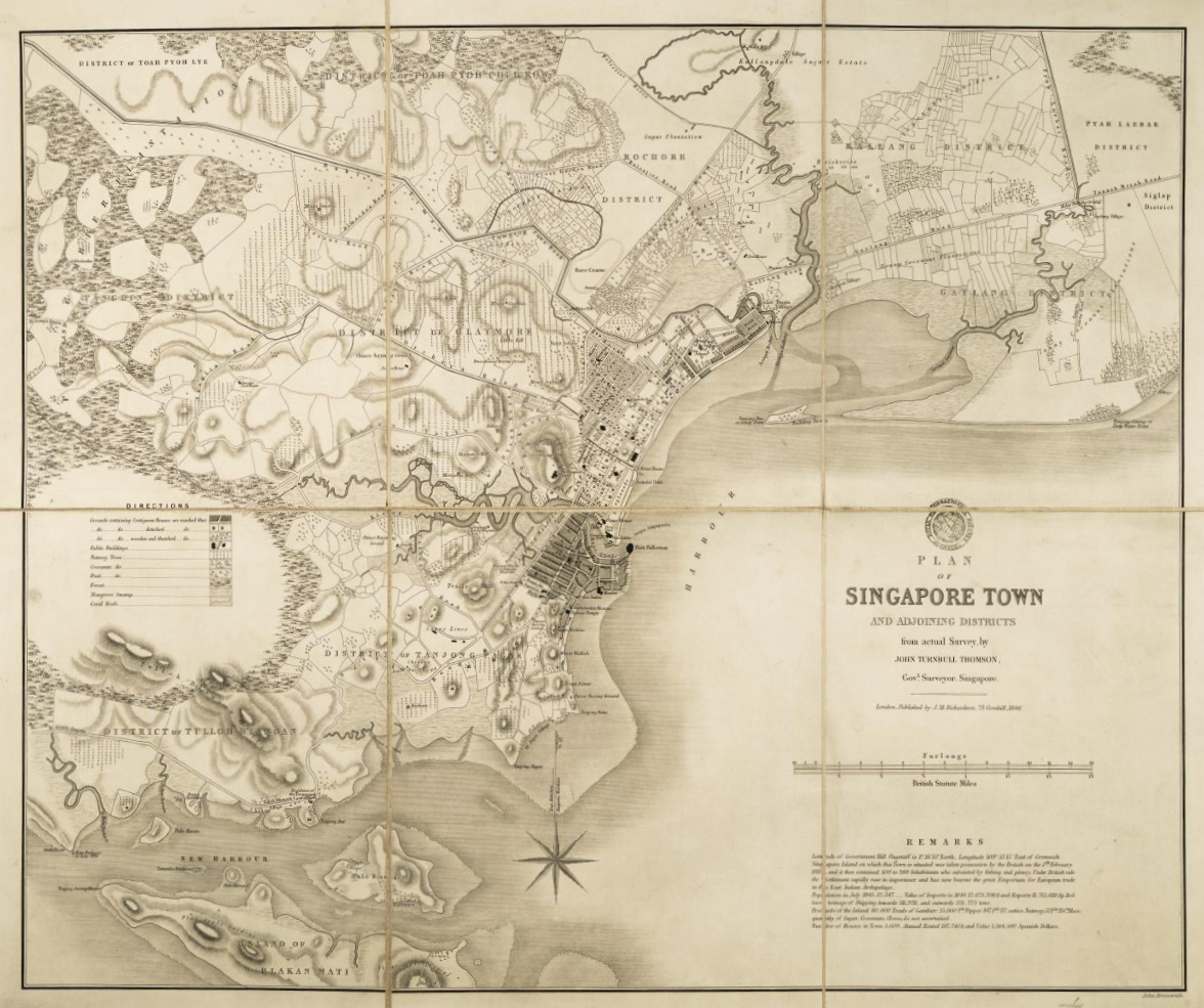 |
| In this 1846 edition of ”Plan of Singapore Town and Adjoining Districts” by then Government Surveyor John Turnbull Thomson, Fort Canning Hill has been renamed “Government Hill”. The map also marks the locations of two prominent structures on the hill at the time: Government House and the flagstaff. While these structures and the renamed hill had been included in earlier survey maps, such as G.D. Coleman’s “Map of the Town and Environs of Singapore” (1839), they were not as clearly labelled as they are in Thomson’s map. This map is considered the most detailed map of Singapore’s town in the mid-19th century. (Image Credit: Survey Department, Courtesy of National Archives of Singapore) |
Government House
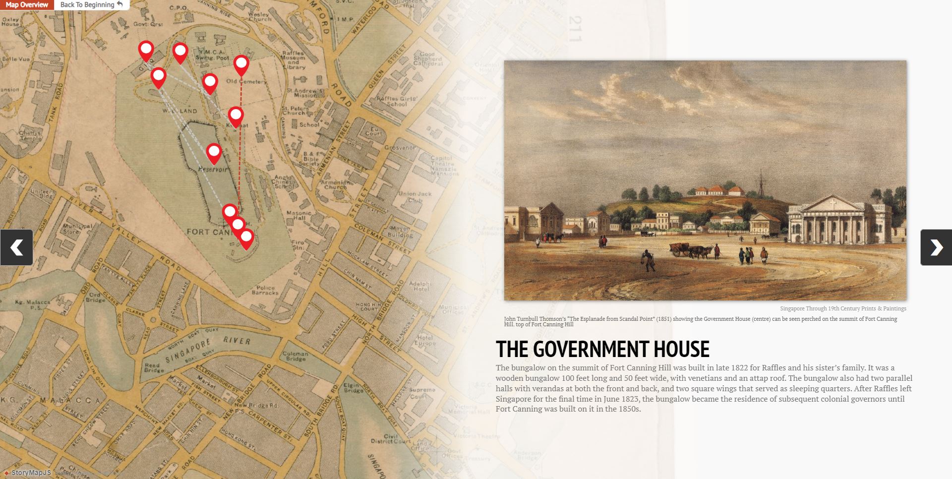
The bungalow constructed on the summit of Fort Canning Hill was built in late 1822 to house Sir Stamford Raffles and his sister’s family. The wooden bungalow was about 100 feet long and 50 feet wide, with Venetian blinds and an attap roof. The bungalow featured two parallel halls with verandas at the front and back and two square wings that served as sleeping quarters. After Raffles left Singapore for the final time in June 1823, the bungalow was used as the residence of subsequent colonial governors until the 1850s, when it was demolished to make way for the construction of Fort Canning.
Raffles enjoyed staying in his bungalow on Fort Canning Hill, even though it was a simple structure. In fact, he liked it so much that he even suggested in his letter to orientalist and numismatist William Marsden dated 21 January 1823 that he wanted to be buried there. Click or tap HERE to read what Raffles wrote which can be found in Letters and books of Sir Stamford Raffles and Lady Raffles (2009) (p. 535). (Source: Call no.: RSING 959.5703092 BAS)
"We have lately built a small bungalow on Singapore Hill, where though the height is inconsiderable, we find a great difference of climate. Nothing can be more interesting and beautiful than the view from this spot. I am happy to say the change has had a very beneficial effect on my health, which has been better during the last fortnight than I have known it for two years before. The tombs of the Malay Kings are however, close at hand; and I have settled that if it is my fate to die here, I shall take my place amongst them: this will, at any rate, be better than leaving one's bones at Bencoolen..."
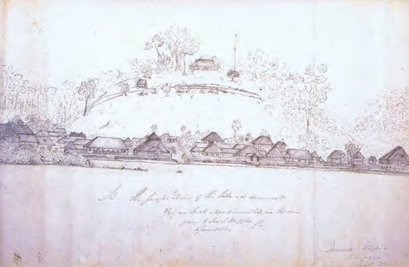 |
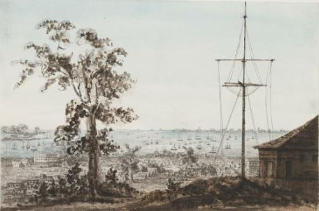
| Sketched by Lt. Phillip Jackson on 5 June 1823, this is the earliest known drawing of a view of Singapore from the sea. The drawing provides a rare glimpse of what Singapore looked like at the time. Other than a row of buildings with attap roofs along the seafront, Raffles’ bungalow on Fort Canning Hill can also be seen in the background near a flag pole. This picture is from the Drake collection of documents and personal effects belonging to Stamford Raffles, and was published in the July 1953 issue of of the Journal of the Malayan Branch of the Royal Asiatic Society (Call no.: RCLOS 959.5 JMBRAS). (Image Credit: All rights reserved, “Singapore from the Sea, June 1823. Notes on a Recently Discovered Sketch attributed to Lt. Phillip Jackson”, Journal of the Malayan Branch of the Royal Asiatic Society, Pearson, H. F., 1953, 26, no. 1 , p. 161.) |
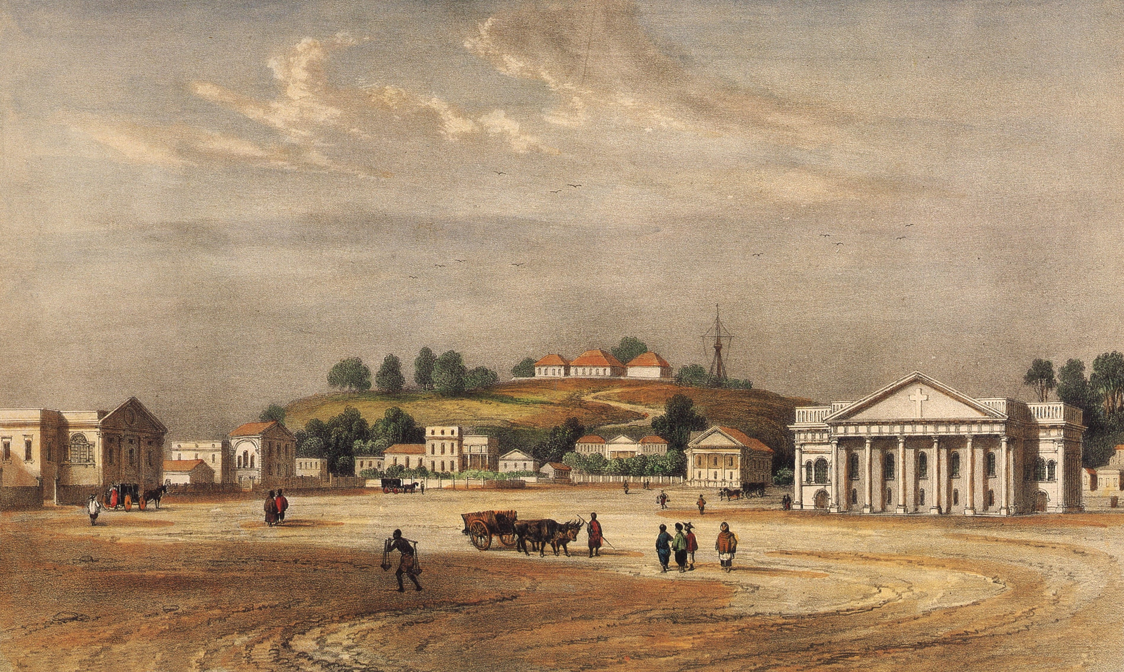 |
| Raffles’s bungalow, which later became Government House, was also captured in many early paintings including this 1837 lithograph taken from Singapore Through 19th Century Prints & Paintings (1989) (Call no.: RSING 769.499595703 WON). Painted and engraved by Barthelemy Lauvergne and Louis Bichebois respectively, it looks across an open space (present-day Padang) towards a somewhat distorted perspective of Fort Canning Hill where Government House and the flagstaff are both visible. Other 19th century paintings that provide a view of Fort Canning Hill with these structures include John Turnbull Thomson’s “The Esplanade from Scandal Point” (1851) and Percy Carpenter’s “View of Singapore from Mount Wallich” (1856). (Image Credit: All rights reserved, Wong, Hong Sen (1999). Singapore Through 19th Century Prints & Paintings. National Museum of Singapore: Editions Didier Millet) |
 |
| IIn 1828, Marianne Jane James, wife of Bishop of Calcutta (1827 to 1828), Thomas James, painted the above painting that not only provides a view of Singapore Harbour, but also a close-up of Government House (far right) and the flagstaff (centre-right). At the time, Government House had been made the official residence of the Governor following Raffles’s final departure from Singapore in June 1823. It had also been redesigned in the neoclassical style by G. D. Coleman with two additional new wings. The building served the Governors until Fort Canning Hill was taken over by the military. Thereafter, the Governors spent 11 years without an official residence, until the new Government House (present-day Istana) was completed in 1869. (Image Credit: Courtesy of the National Museum of Singapore, National Heritage Board) |
Becoming Fort Canning
Fort Canning was built on the site of Government House. Named after Viscount Charles John Canning, Governor-General and First Viceroy of India from 1856 to 1862, it was completed in 1861. The fort was constructed to protect Singapore from a possible sea attack and to maintain security in the town.
Sir Stamford Raffles first proposed for a fort to be built in one of his letters to the first Resident of colonial Singapore William Farquhar in 1819. Click or tap HERE to read what he wrote. (Source: National Archives of Singapore)
"...On the hill overlooking the Settlement and commanding it and a considerable portion of the anchorage, a secure? fort, or a commodious blockhead on the principle which I have already described to you, capable of mounting 8 or 10 twelve-pounders, and of containing a magazine of brick or stone, together with a barrack for the permanent residence of 30 European artillery, and for the temporary accommodation of the rest of the garrison, in case of emergency."
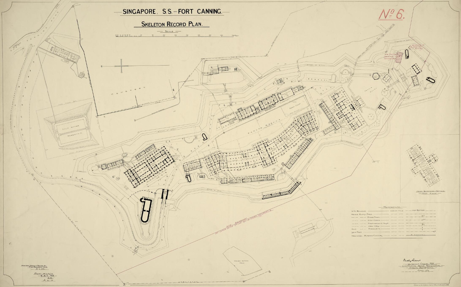 |
| Fort Canning was built by some 400 Chinese coolies and had several buildings for the garrison stationed there. They included barracks, officers’ quarters, a hospital and two gun-powder magazines. The fort also had a moat, thick fort walls that were able to withstand artillery bombardment, and a wide variety of armaments including seven 68-pounders, eight 8-inch shell guns, and two 13-inch mortars. By the early 1900s, as seen in the plan above, the fort had expanded considerably with more barracks, a parade ground and even tennis courts. (Image Credit: National Archives UK, Courtesy of National Archives of Singapore) |
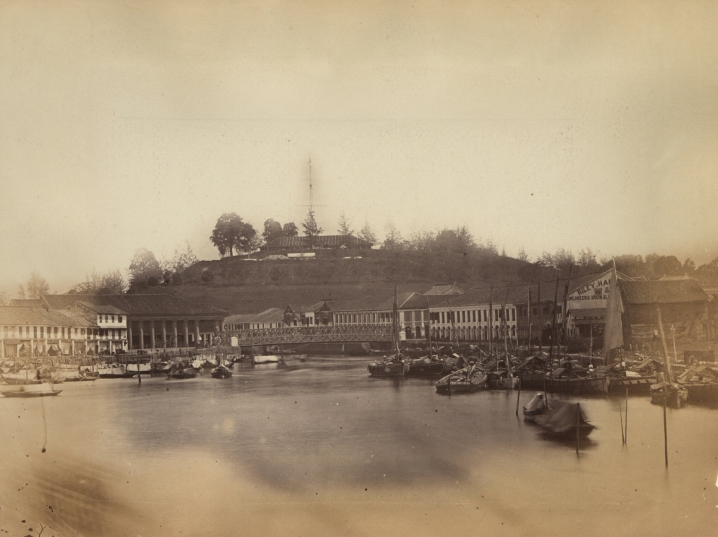 |
| Despite offering extensive defences, the local European community questioned the decision to build the fort on the hill as it was too far from the shore thus rendering the cannons and guns ineffective against enemy ships at sea. Furthermore, when the fort was completed, the soldiers complained they were unable to use the cannons because their aim was obstructed by the neighbouring Pearl’s Hill which was four metres higher. This prompted the colonial government to order the Military Engineer to cut the top off Pearl’s Hill. (Image Credit: Courtesy of National Archives UK via Wikicommons) |
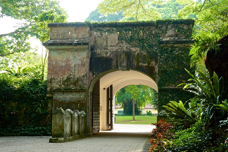 |
| In the end, Fort Canning never saw battle. Instead, its 68-pounder cannons were used to indicate time and signal outbreaks of fire. The fort was eventually decommissioned in 1907 and demolished in 1926 to make way for a reservoir. By then, a time-ball, a lighthouse and a telegraph office had been erected on the hill. Together with the existing flag staff, Fort Canning Hill was functioning as a signal and communication station. Today, remnants of the old fort can still be found on the hill. These include the main gate, a sally port and parts of the original wall. (Image Credit: Photo by Uwe Schwarzbach via Flickr) |
The Malaya Command
Although Fort Canning was demolished in 1926, British military presence continued with the establishment of the Malaya Command headquarters in a new military complex which was completed in 1927. After the fall of Singapore in 1942, the Japanese Army took over the compound before it was returned to the British in 1945. In 1963, the complex was handed over to the 4th Malaysian Infantry Brigade and then to the Singapore Armed Forces in 1970. Today, the premises is occupied by Legends at Fort Canning Club, a five-star luxury heritage boutique hotel known as Hotel Fort Canning, and the Fort Canning Centre.
What is the Malaya Command? Click or tap HERE to find out what Singapore: The Encyclopedia says. (Source: Call no.: RSING 959.57003 SIN)
"From 1929 to 1957, overall control of British land forces in Malaya and Singapore came under the Malaya Command...[It] was divided into sub-districts. Singapore was one of these sub-districts, being referred to as 'Singapore Fortress' up until World War II, and Singapore Base District thereafter."
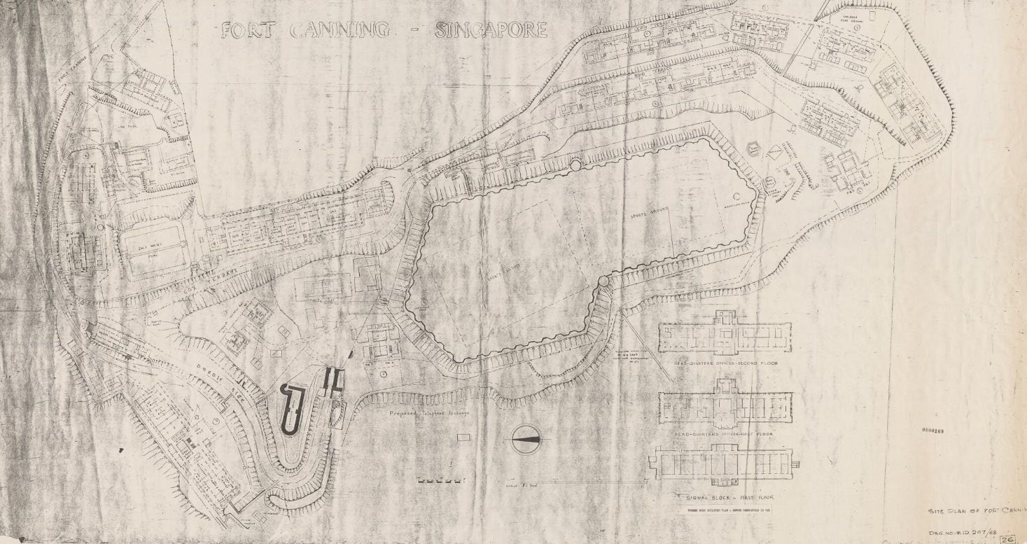 |
| Built at a cost of $650,000 in 1926, the military complex of the headquarters of the Malaya Command on Fort Canning Hill comprised an administration building, a barracks block, and quarters for married soldiers and warrant officers. The project was conceived as a replacement for Fort Canning which had been decommissioned in 1907 and slated for demolition to make way for a service reservoir which was completed in 1929. Shown here is the 1921 site plan of Fort Canning. (Image Credit: National Parks Board, Courtesy of National Archives of Singapore) |
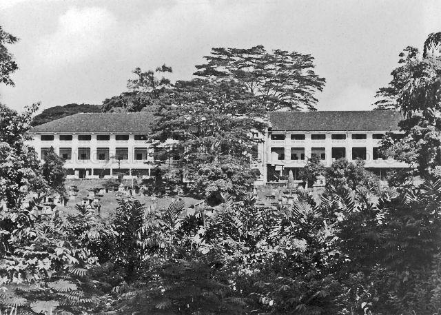 |
| The administration building and barracks were the centerpiece of the new military complex on Fort Canning Hill, built at a cost of $650,000 in 1926. They were designed similarly in the neoclassical architectural style by the Municipal Architects Department and located on the north and east side of the hill respectively. Both buildings were about 300 feet long, with a 10-foot tall verandah around them and high ceilings to ensure plenty of ventilation. Additionally, both buildings had large roof overhangs to provide shelter from the sun and rain. The administration building had a 24-foot wide double staircase facing its main entrance. The building included garage spaces, storerooms, and various military offices, including the office of the General Officer Commanding for Malaya on the third floor. A photograph of the building taken in the 1950s is shown here. (Image Credit: George Tricker Collection, Courtesy of National Archives of Singapore) |
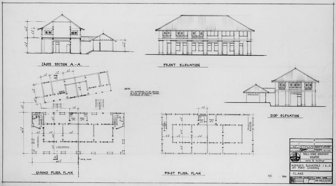 |
| As for the barracks, there were dining rooms for non-commissioned officers (NCOs) and other ranks, each with its own kitchen, canteen, billiard room, and lecture room. The dormitory provided accommodation for up to a hundred men, and was divided into three sections, each with cubicles for NCOs at the end. Finally, scattered between the barracks and the administration buildings were five blocks of quarters for married soldiers that “commanded a fine view of the harbour and town”. Shown here is a building plan of these married soldiers’ quarters. (Image Credit: National Parks Board, Courtesy of National Archives of Singapore) |
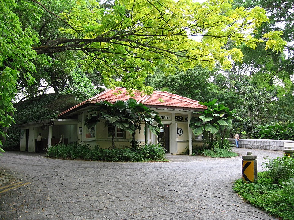 |
| Between 1936 and 1941, the British built a bunker with a tunnel network nine metres beneath the military complex as the command centre for the Malaya Command during World War II. Bomb- and flood-proof, the underground structure was “a self-containing centre” equipped with an electricity generator, a ventilation system and over 20 purpose-built rooms. On 15 February 1942, it was here that Lieutenant-General Arthur E. Percival and the Allied forces made the decision to surrender to the invading Japanese forces. The bunker was abandoned before it was reopened on 15 February 1997 as a WWII educational and tourist destination known as The Battlebox whose ticketing office is pictured here. It was formerly one of the married soldiers’ quarters. (Image Credit: Photo by Sengkang via Wikicommons) |
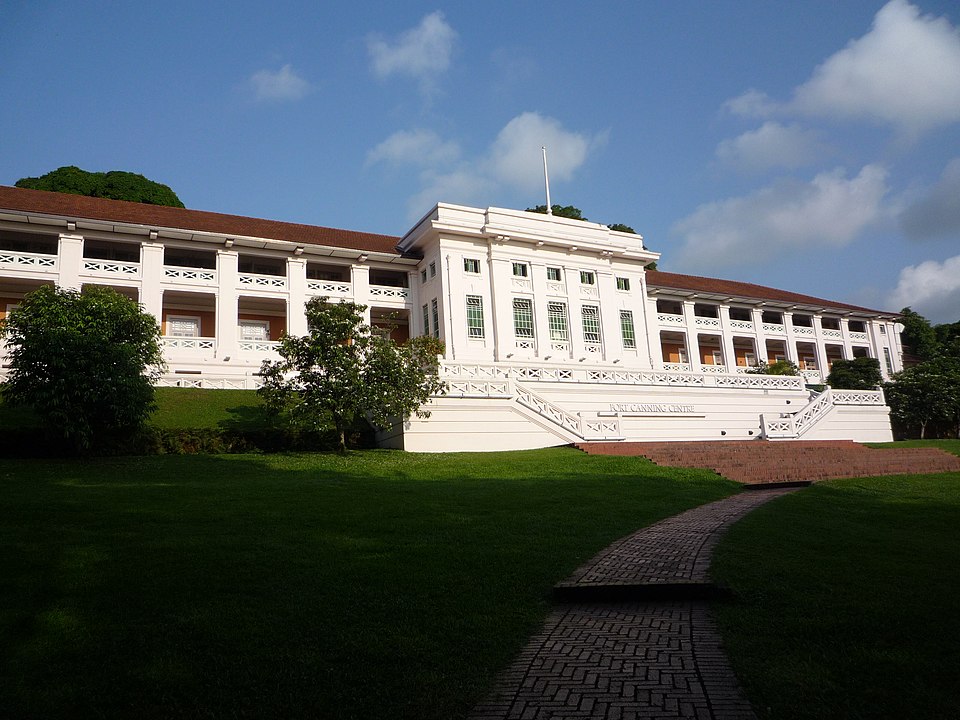 |
| The administration building and barracks were also repurposed for civilian use in the 1970s. The barracks (shown here) is now known as The Fort Canning Centre. It was converted into a squash court venue and later transformed in the 1990s into a space for the arts, housing two of Singapore’s prominent arts groups – the Singapore Dance Theatre (SDT) and TheatreWorks. Between 2015 and 2016, it briefly served as the private art museum Singapore Pinacothèque de Paris. In 2019, The Bicentennial Experience, which showcased the nation’s 200-year history, was hosted at this location. (Image Credit: Photo by jean-michel gobet via Wikicommons) |
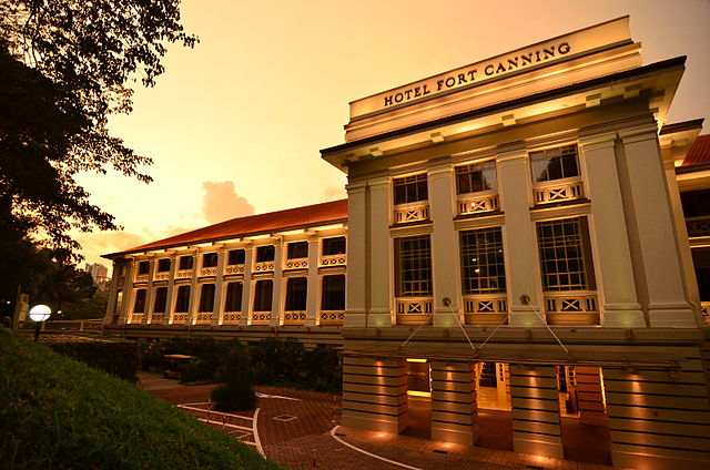 |
| The administration block has been functioning as a country club since 1995. Today, the country club is known as Legends Fort Canning Park. Incorporated in 2002, the club offers its members world-class amenities and recreational facilities. It also set up a five-star boutique hotel, Hotel Fort Canning, within its premises. (Image Credit: Photo by Nicolas Lannuzel via Wikicommons) |
The Battlebox
One of the most iconic buildings on Fort Canning Hill is the underground bunker of the Malaya Command. Known today as “The Battlebox”, the bunker is where the British made the decision to surrender Singapore to the invading Japanese forces on 15 February 1942. Get a glimpse of what is inside the bunker and how it functioned as a self-sufficient military headquarters during the war in this video by Today newspaper.
Explore The Colonial Buildings Of Fort Canning Hill
Take a trip back in time in this story map to learn more about the history of some of the iconic buildings and sites on Fort Canning Hill.


